Whenua
“Toitū he kāinga, whatungarongaro he tangata.” / The land remains when the people have gone.
Ko au ko te whenua. If the land is the people, then the map can't just be a board for the game to sit on. It needs to look like Aotearoa in 1810, change through the year the way the land did, and give food the way the land gave it. This post covers how I researched the land itself, the imagery I'm pulling, how I'm prepping it for 3D, how the seasons and regions should feel, the key landmarks, and the food calendars that drive what each place gives through the year.
What it looked like/1810
Modern map data shows the land as it is now, with farms, pine forests, towns and drained swamps. So I started from the ground up. LINZ topographic data gives the coastline, rivers, lakes, swamps and sand. Landcare Research's potential vegetation layer gives the forest that stood before people arrived, from kauri and taraire in the north to beech in the south.
That still isn't 1810. By then Māori had been burning and gardening for centuries, and large areas had opened into fernland and scrub. To get closer, I georeferenced two maps of New Zealand's vegetation around 1840, one from Te Ara and one from evidence Greater Wellington Regional Council filed with the EPA, and traced their forest, scrub, grassland and swamp boundaries onto the base map. The forest you see is the forest the sources put there, and the open country around settlements comes from the people who lived in it.
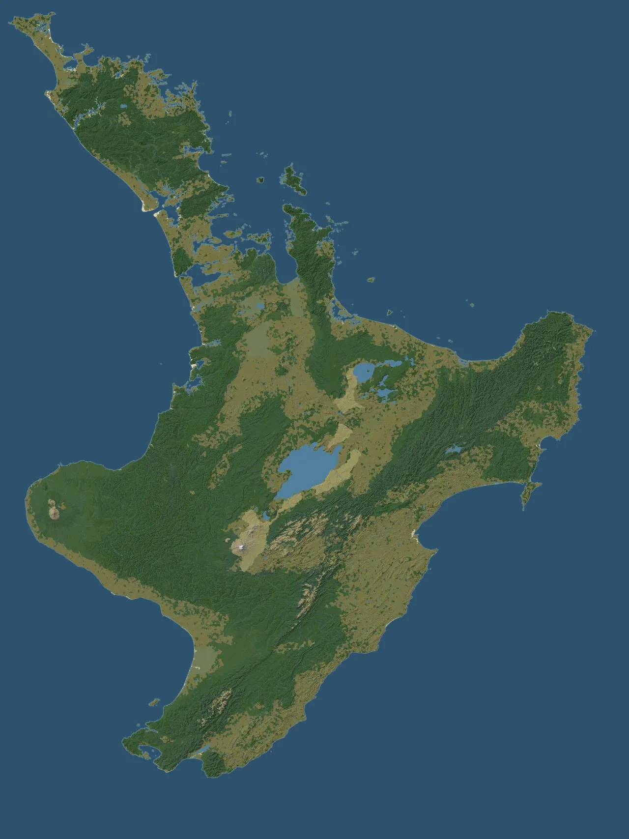
Height comes from the LINZ contours, around 252,000 lines running from sea level up to 2,780 m on Ruapehu. I filled those into an elevation surface and shaded it. Above the treeline the cover changes with height, from tussock to bare rock and scoria, up to the pale summit of Ruapehu. Small things matter too. Most of the inland "sand" in the LINZ data is shingle riverbed, so it's drawn as gravel, and only sand near the sea shows as beach.
Some of the land has changed shape since 1810, and the map has to undo that:
- The Hauraki Plains and lower Waikato were swamp and kahikatea forest until drainage began in the early 1900s.
- Te Whanganui-a-Orotū, the Ahuriri lagoon at Napier, was 3,000 to 4,000 hectares of open water until the 1931 earthquake lifted it dry.
- The Wellington coast sat lower before the 1855 earthquake, which raised it by up to 6.4 m at Turakirae. The harbour edge ran further inland and Wairarapa Moana was larger.
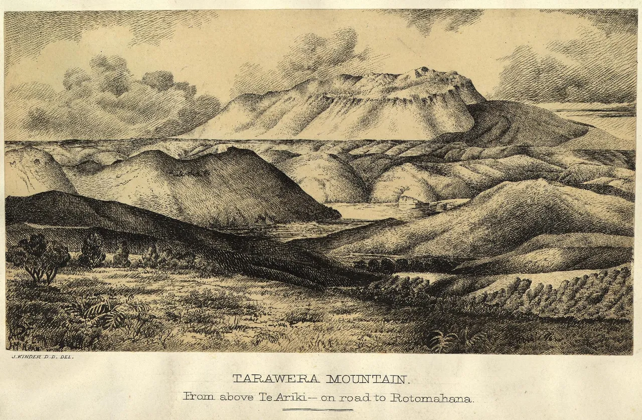
- Tarawera stood as three intact domes, with no rift, and Te Otukapuarangi and Te Tarata, the Pink and White Terraces, sat on a smaller Lake Rotomahana. All of that changed in 1886.
- Lake Ōmāpere was lowered between 1903 and 1929, so its 1810 shoreline is still uncertain.
- The Tāmaki cones were terraced pā and gardens, not quarries, and kauri covered far more of the north.
The map is also warped. The north, where most of the early part of the game happens, takes up more room than it would on a true map, and every place, track and resource area sits in the same warped space so they all line up. The full North Island comes out at 18,432 by 24,576 pixels, about 40 m to a pixel.
Imagery
Data tells you where the forest was. It doesn't tell you what it looked like from the ground. For that I'm pulling the work of the landscape painters and sketch artists who came through between Cook's voyages and the 1870s. The key ones for the north are Augustus Earle, who spent 1827 and 1828 in the Hokianga and Bay of Islands, Louis Auguste de Sainson on d'Urville's 1827 voyage, and Edward Ashworth in 1842 to 1844. Charles Heaphy, Joseph Jenner Merrett and George French Angas cover pā, kāinga, kauri forest and the central plateau in the 1840s. Cyprian Bridge and Lance-Sergeant John Williams of the 58th Regiment drew the pā of the Northern War, Ruapekapeka included. John Kinder painted the Pink and White Terraces in 1866, twenty years before they were lost.
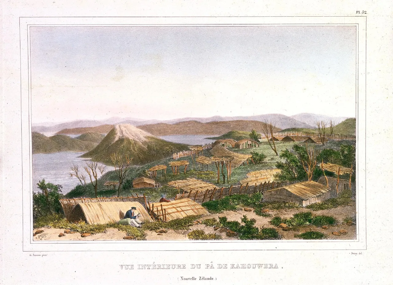
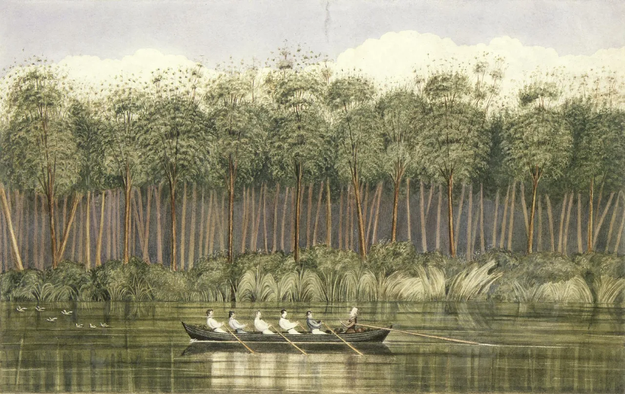
These works are useful for vegetation, pā layout, gardens, waka and the shape of the coast. They aren't neutral. Most were made for European audiences and many lean on the picturesque, so I'm reading them against the data rather than copying them. Some carry restrictions too. Ngāti Tūwharetoa have had some of Angas's watercolours marked as wāhi tapu, and those stay out of the project.
Prepping for 3D
The game map will be stylised 3D terrain in the style of a campaign map. Battles stay as event sequences, so there's no tactical 3D layer. The plan is to take the LINZ elevation model, move it into the same warped map space, displace it in Blender and dress it with the environment toolkit I built for Te Hīkoi, which handles mass foliage and painterly distance.
The key rule here is that the map must read before it is beautiful. It starts as a greybox, with the land shape, rivers and settlements all clear and playable, and the art pass comes after. The north gets the full treatment first, since that's where the core slice is played.
Nature assets
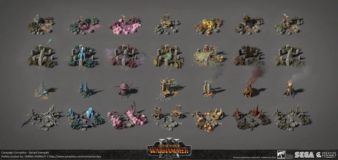
The map is aiming for the fidelity of a Total War campaign map, so I've been looking at how Creative Assembly's artists build theirs. Emma Charnley's campaign vegetation for Total War: Warhammer III is the clearest example. Each landscape type is a kit of a few trees, shrubs and ground plants, and the same kit gets recoloured into a set of colour schemes for different climates and seasons.
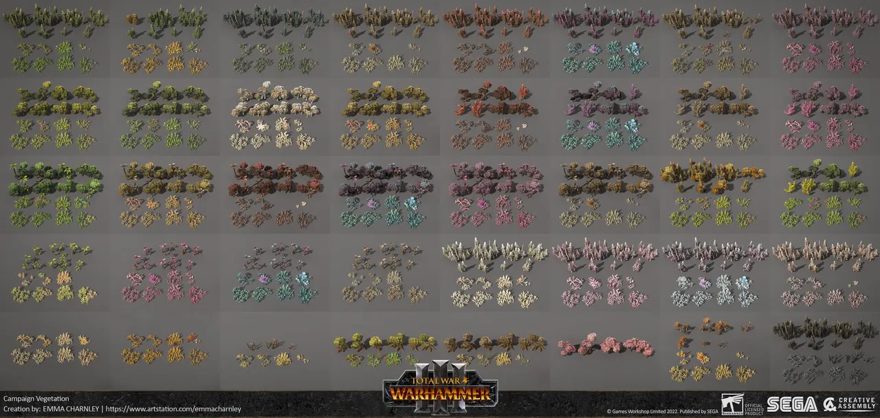
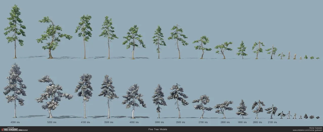
I'm building the bush the same way. Each tree shape is one 3D model, and everything that changes sits in its textures. Tawa, taraire, kohekohe, tītoki, hīnau and kāmahi all share one broadleaf model and differ by texture. Pōhutukawa is one model with a base texture and a flowering one that swaps in for December. Michal Gutowski's trees for Three Kingdoms come as a growth series of about a dozen sizes, each with a snow version. Taua keeps it to three sizes per tree, mature, young and sapling, plus a dead one for burnt ground.
Nothing is built yet. The first list has 46 models, which comes to 100 meshes once the tree sizes are counted, carrying 128 texture sets:
- Trees (18): kauri and young kauri, a podocarp column for kahikatea, a weeping podocarp for rimu, mataī, miro and tānekaha, tōtara, the broadleaf canopy, a spreading broadleaf for pūriri and karaka, northern and southern rātā, beech, mountain beech, pukatea, pōhutukawa, kōwhai, nīkau, tī kōuka, tree ferns and mangroves.
- Shrubs and plants (13): mānuka and kānuka, broadleaf shrubs, subalpine shrubs, matagouri, harakeke, toetoe, raupō, tussock, dune grasses, rushes, bracken, forest ferns, and alpine herbs and cushions.
- Rock (10): basalt and scoria, volcanic cliffs, limestone for the karst country around Waiōmio and Kawakawa, greywacke, papa, pumice and ignimbrite, a set of stacks and arches, reef platforms, round boulders, and southern granite and schist.
- Water and geothermal (5): a waterfall kit, rapids, the silica terraces, hot and mud pools, and a geyser.
Kits
Each landscape type on the base map gets its own kit, with the share of trees, shrubs and ground cover set as percentages. There are 35 so far, split by region wherever the species change, and each one is tied to real places I can point to for reference. Northern kauri forest, for example, is 30% kauri, 30% taraire, 15% rimu and tānekaha, 15% young kauri and 10% pūriri in the canopy, over tree ferns, nīkau and kawakawa. Central forest drops the kauri, taraire and pōhutukawa and puts rimu over tawa and kāmahi. Kahikatea swamp forest is 70% kahikatea over tī kōuka, harakeke and wet ground. Bracken fernland is mostly fern with scattered mānuka, tī kōuka and basalt, which was the look of most open northern country in 1810. Mangroves only go into estuaries north of Kāwhia and Ōhiwa.
The newer kits pick up the landscapes that give the map its character. Gumland heath covers the stunted mānuka and Dracophyllum on the old kauri soils of the far north. Restiad peat bog covers the giant cane rush domes of the Hauraki Plains around Kopuatai, near Kerepehi, and the Waikato bogs. Plateau tussock covers the Desert Road and Rangipō country below Ruapehu. There are kits for West Coast pakihi, the giant dunes at Te Paki, Rangitoto's lava, the limestone karst around Waiōmio and Waitomo, braided rivers, alpine herbfield and scree, glaciers, Taranaki's moss forest, the papa gorges of the Whanganui, Fiordland, the schist tors of Central Otago and wind-shorn coastal turf.
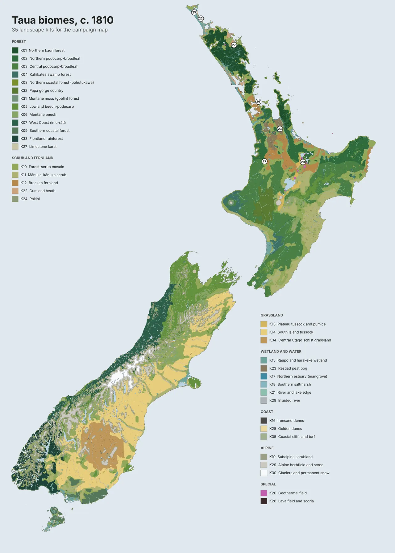
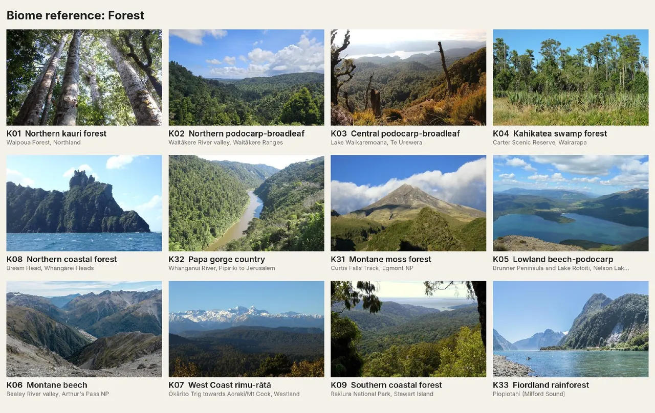
To map them I combined the cover around 1840 with Landcare Research's potential vegetation, which is based on Leathwick's model of New Zealand's natural forest pattern, and LINZ data for sand, swamps and rivers. The cover sets whether a place is forest, scrub, grassland, swamp or alpine, and the potential vegetation sets what kind: kauri, podocarp, beech or swamp forest. A few places, like the geothermal fields, Rangitoto and the karst country, are drawn in by hand. For each kit I've also collected modern photos of the real places as reference. They show what each kit needs to read as from a distance, even though the land has changed since 1810.
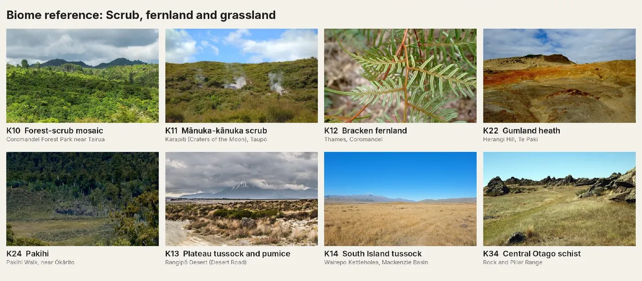
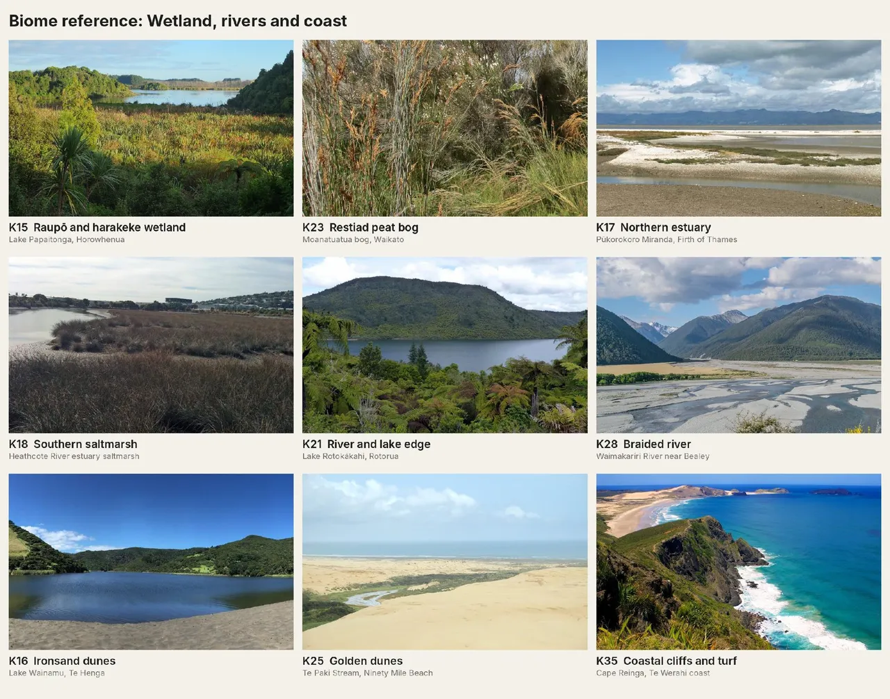
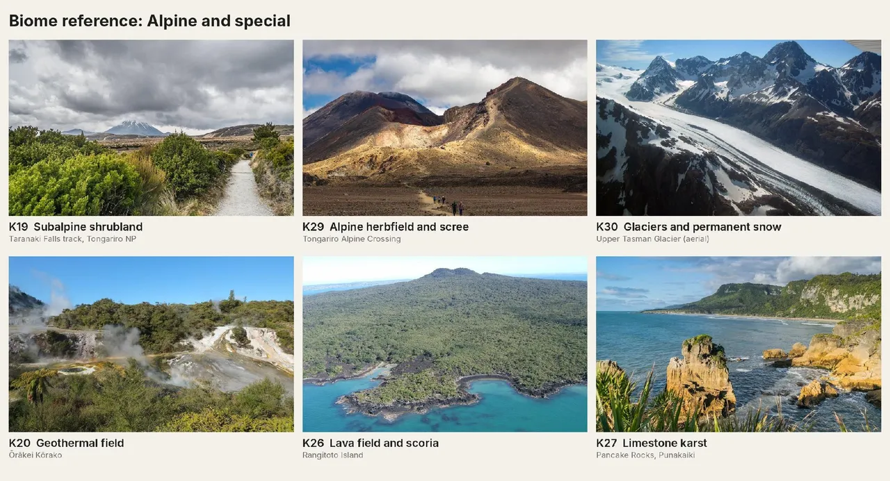
Each kit's colour schemes come straight from its models' textures. Northern coastal forest, for example, runs through pōhutukawa flowering in December and January, karaka and nīkau fruit from February to April, pūriri flowering over winter, and harakeke and tī kōuka in flower from October. That gives 206 schemes across the 35 kits.
Land states
Charnley also shows one piece of landscape in several states. Taua needs the same for land that burns and grows back. Forest that burns goes to dead trees and black ground, then bracken fernland within a year or two. Left alone, fern gives way to mānuka and kānuka scrub, then a mix of scrub and young forest, and eventually mature forest again, with the podocarps last. Repeated burning holds land at fernland, which is how a lot of open country around kāinga was kept for aruhe. Each state is one of the kits, so the change costs no new models, only the dead tree meshes and burnt textures.
Seasons in the textures
Most native trees are evergreen, so autumn colour doesn't work as a season marker here. Instead, each model has seasonal textures: pōhutukawa and rātā in flower over summer, kōwhai in spring, mānuka going white, tawa, miro and karaka in fruit, raupō browning in winter, bracken turning rust, tussock going gold, and snow loading on mountain beech, tussock and subalpine shrubs. Terrain layers do the rest, with snow, frost, valley fog, browning grass on the east coast, steam on cold mornings and surf.
Animals
Like a Total War campaign map, the land and sea need some life moving through them. The first list has ten animals: tohorā (southern right whales) in the bays over winter, sperm whales offshore, dolphin pods, seal colonies, kuaka wheeling over the mudflats from September to March, rafts of seabirds, kererū over the canopy, kāhu circling the open country, ducks on the lakes, and feral pigs at the forest edges.
Pā, kāinga, gardens and the rest of the land people shaped will be the next post.
Seasons
Turns are monthly, so the land needs to feel different month to month. A player should be able to look at the map and tell the time of year. A few signals run across most of the country:
- Kōwhai flowering yellow along the rivers from August to October. The spring showers are ua kōwhai.
- Puawānanga, white clematis, draped over the canopy from August into November.
- Harakeke in flower in October and November, and toetoe plumes standing from November into autumn.
- Kuaka arriving in September and leaving in March, gathering in their thousands at Parengarenga, Kaipara, Manukau, Tīkapa Moana and Onetahua before they go.
- The pīpīwharauroa calling in spring, and the koekoeā arriving about October.
- Matariki rising before dawn in late June or early July. In Taranaki and Whanganui, and for some South Island iwi, Puanga marks the new year instead, since Matariki sits low there.
- Gardens changing through the year, from cleared ground in spring to planted mounds, then green leaf over summer, then bare after the harvest is lifted in autumn.
- The food calendar at work, like eel weirs set in the rivers in autumn and people moving into the forest for birding over winter.
Regions
On top of the biomes, each region should have its distinct unique character. I’m still undecided on how exactly to represent this, be it camera tinting, unique animations or other means. In lieu of a technique i’ve chosen to divide up the country into regions and then detail what character they should have.
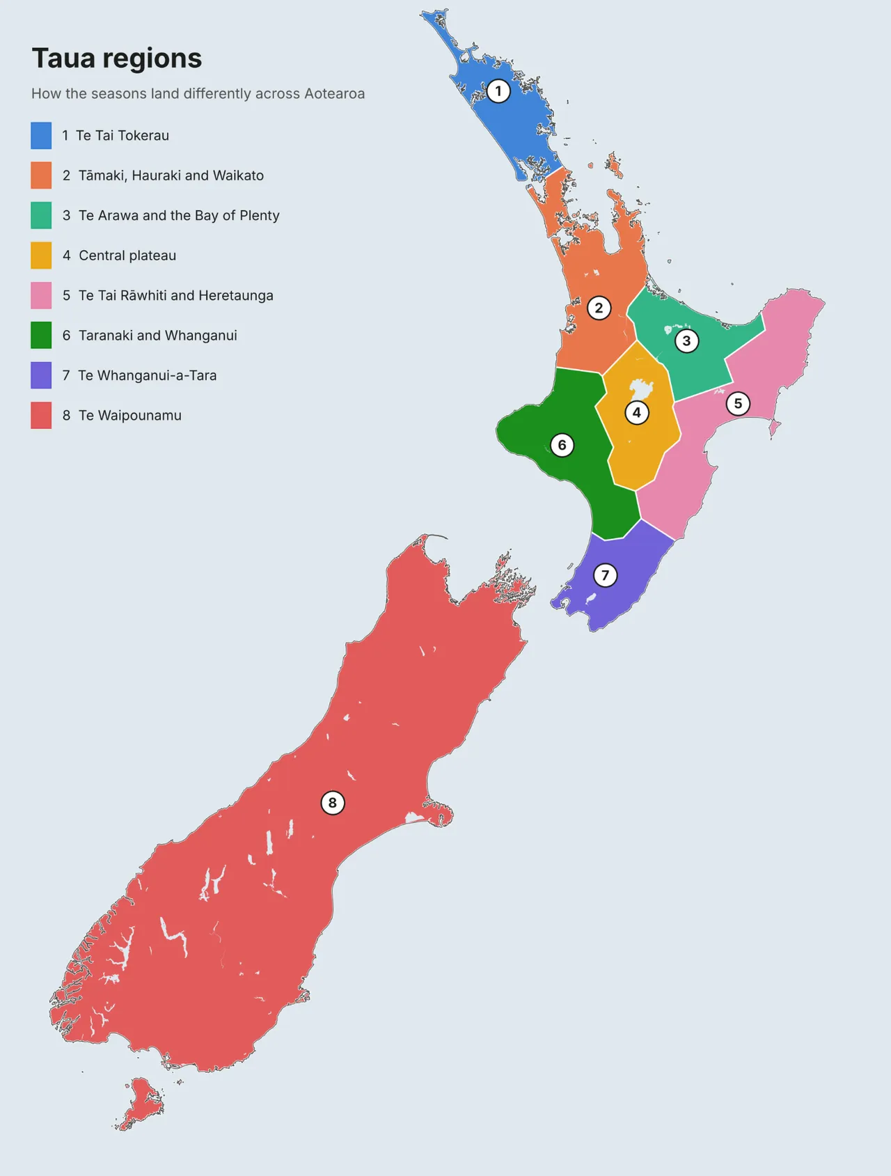
Te Tai Tokerau
The winterless north. Frost is rare, winter is the wet season, and summer brings humid air and the odd cyclone. Pōhutukawa turn the coast red in Hakihea (December), rātā follow in the forest, and pūriri flower through winter with kererū feeding on them. Kauri forest stays dark green all year. The west coast is surf and dunes, the east is sheltered bays and islands, and at Te Rerenga Wairua the two seas meet in broken water.
Tāmaki, Hauraki and Waikato
Rain all year, with the east sunnier than the west. Winter brings thick fog and hard frosts to the Waikato basin on still nights, and floods spread across the swamps. Godwits fill the Manukau and Tīkapa Moana from spring to autumn.
Te Arawa and the Bay of Plenty
A mild, sunny coast lined with pōhutukawa, and Whakaari steaming offshore. Inland around Rotorua it's cooler, with winter frosts. The geothermal fields should steam hardest on cold, still winter mornings.
Central plateau
Snow on Tongariro, Ngāuruhoe and Ruapehu, heaviest from June to October, with frost possible in any month up high. Tussock and pumice plains turn gold and dry over summer, and the Rangipō desert stays bare all year. Snowmelt swells the rivers in spring, and Huka and Aratiatia run at full natural flow.
Te Tai Rāwhiti and Heretaunga
The sunny, dry east. Hot nor'westers brown the hills from January to March, and winter brings frosts on the flats and snow on the Ruahine and Kaweka ranges. Hikurangi takes the first light of the day. Pōhutukawa reach their southern limit at Māhia.
Taranaki and Whanganui
Wet westerlies keep the region green year-round, and the beaches are black ironsand. Taranaki carries a heavy snowcap from winter into spring and shrinks to a patch or bare rock by late summer. Fog sits in the Whanganui gorges, and the river floods in winter.
Te Whanganui-a-Tara
Wind is the defining feature, with Cook Strait funnelling northerlies and southerlies through. Southerly busters bring snow to the Remutaka and Tararua ranges in winter, Wairarapa browns over summer, and the strait whitens in the spring gales.
Te Waipounamu
Canterbury has the widest temperature range of the main centres, with hot nor'westers under the nor'west arch in spring and summer and hard frosts in winter. The Southern Alps hold permanent snow, and the snowline drops to the foothills in winter. The West Coast is the wettest region in the country, and southern rātā turn its hills red in summer. Otago and Southland have cold winters and inversion fog in the inland basins. Kūmara won't grow south of Banks Peninsula, so southern hapū relied on tī kōuka, birds, eels, fish and tītī.
Key landmarks
Some places need to stand out from the terrain as hand-made models, both so players can find their way and because of what they mean. Each iwi has its own maunga, harbours and awa, named in pepeha and whakataukī. Maunga are tūpuna, and the people of each rohe will have a say in how theirs appear. Some, like Te Rerenga Wairua, Taupiri, Hikurangi, Maungapōhatu, Taranaki and Aoraki, need that conversation before anything gets modelled.
The first list has around 90 places. Some examples:
- Maunga: the maunga of Te Whare Tapu o Ngāpuhi, from Pūhanga Tohora and Whīria to Rākaumangamanga, as well as Maungakiekie, Taupiri, Pirongia, Mauao, Tarawera, Tongariro, Ruapehu, Taranaki, Hikurangi and Aoraki.
- Harbours and moana: Whangaroa, where the Boyd burned, Hokianga with Niua and Arai-te-uru at the heads, Kaipara, Waitematā, Manukau and Kāwhia.
- Geothermal: Whakarewarewa, Tikitere, Ōrākei Kōrako, which was far larger before 1961, Whakaari, and the Pink and White Terraces.
- Ironsands: the black beaches from the Waikato down the Taranaki coast.
- Falls: Haruru at Waitangi, Waianiwaniwa at Kerikeri, Ōtuihau at Whangārei, Wairere and Huka.
- Rocks and coast: Te Kaihinaki (the Moeraki Boulders), Motukōkako, Manaia at Whangārei Heads, Punakaiki and Onetahua.
- Te Nohoanga o Torongare: the seat of Torongare, a large limestone rock at Ruarangi on the south side of Whangārei. It was the lookout of our tupuna Torongare, father of Hineāmaru, and from the top you can see why, with the whole harbour laid out below. It stands for the hapū who hold mana i te whenua there, and those hapū hold its kōrero.
- Pā: Kororipo, Pouērua and the Taiamai cones, Parihaka at Whangārei, Kaiapoi and Onawe.
- Taonga sources: Tūhua for obsidian, Arahura for pounamu, and Rangitoto ki te Tonga for argillite.
Food calendars
The map also needs to know what each place gives and when. I've been working from four seasonal food charts, one each for the whenua, moana, ngā awa and rangi. I combined all four into one calendar.
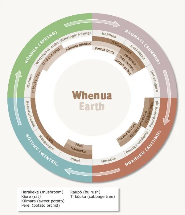
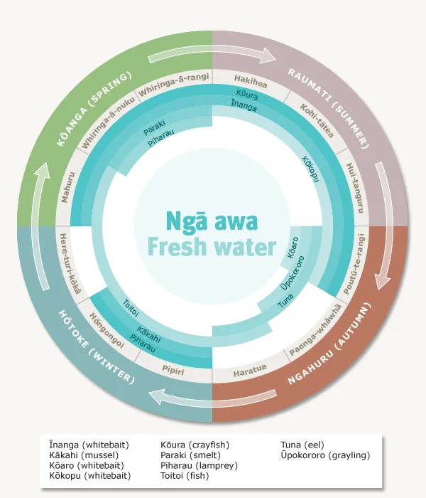
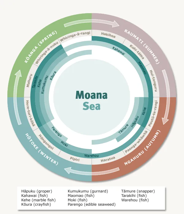
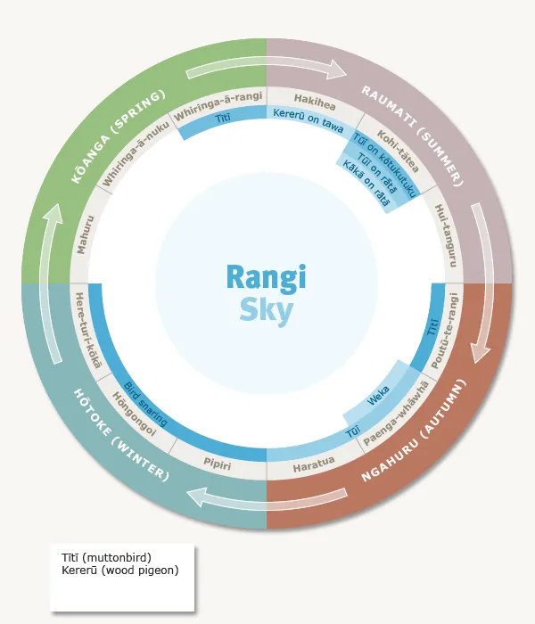
One correction for anyone using the original charts: the whenua chart labels mushrooms as "harakeke". It should read harore.
The charts leave out some key foods, so I did a research pass to add them, with each row sourced. That covers aruhe, potatoes, pigs, shellfish, hue, tawa, hīnau and kiekie, plus the tuna heke by species, the winter kererū take, duck drives, and southern foods like kāuru and Rakiura tītī.
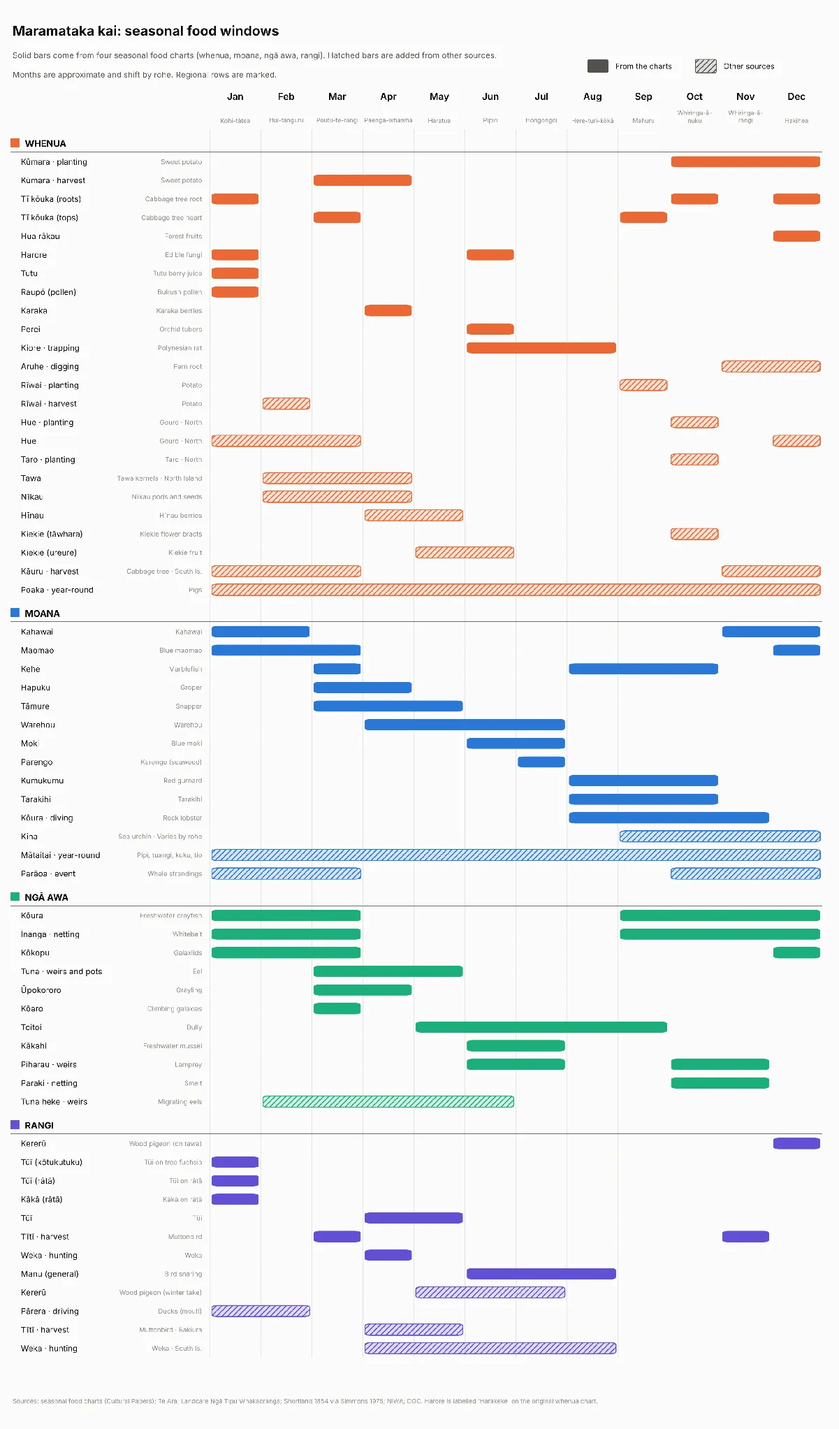
Laid out together, the year has a clear shape. Poutū-te-rangi (March) is the busiest month, with the kūmara harvest, the eel runs starting, tawa and nīkau in the forest, and hāpuku and tāmure coming in. Winter moves into the forest, with birds snared and preserved in fat, and kiore trapped. Here-turi-kōkā (August) is the leanest. From August to October the forest and rivers give little, but the sea carries the spring, with tarakihi, kumukumu and kōura in season and kina from September. That same stretch is when kūmara and potato planting need the most hands, which is the pressure the core loop is built around.
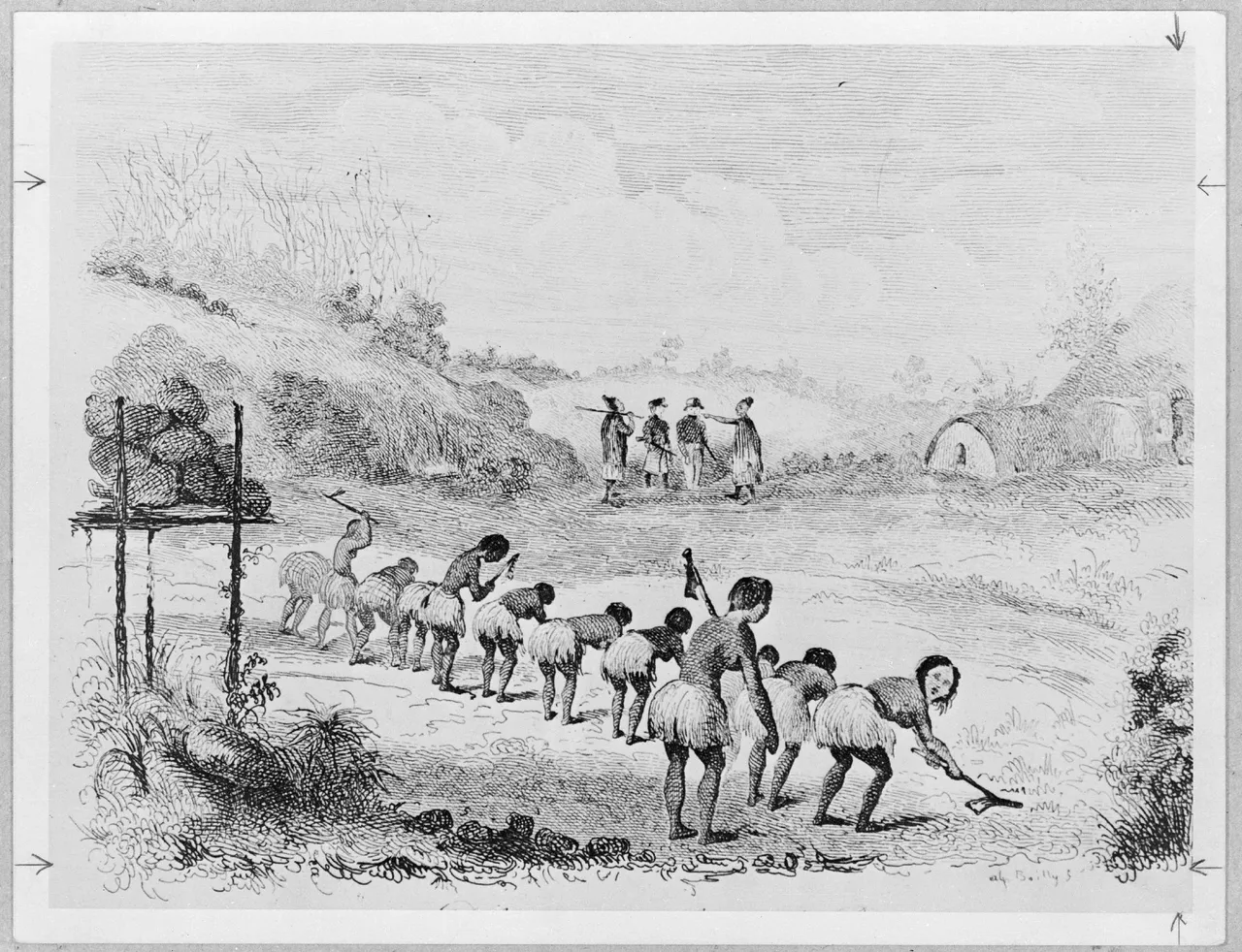
Potatoes change that pressure. Shortland describes bush cleared in July, burnt in summer, planted in September and lifted in February, a month before the kūmara. That gives a hapū with potatoes a second harvest and food in store before autumn.
In the game, each resource area on the map takes its windows from this calendar, weighted for its own rohe, since the charts are general and the timing shifts from north to south and from coast to inland.
Comments