Te Whareumu and Kiwikiwi
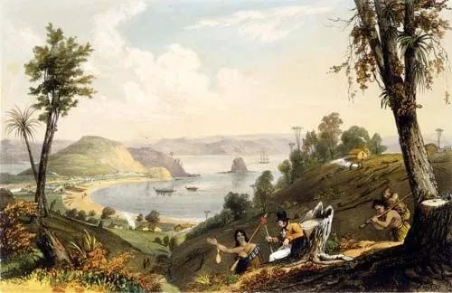
Kororāreka was the beach where the Pacific came ashore in the north. Whalers took on water, pork and potatoes there, deserters stayed, and grog shops followed. Ngāti Manu held it through the 1820s, first under Tara and then under Te Whareumu, whom the sailors called King George. Te Whareumu died at Waimā in 1828, and his brother Kiwikiwi held the beach for two years before losing it in the Girls' War.
Hapū/Ngāti Manu at Kororāreka
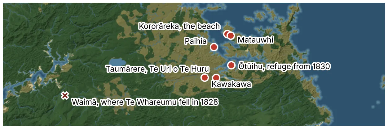
In the Pōmare post I followed Ngāti Manu from Tautoro to the coast. One group followed Hautai, Pōmare I's aunt, to Manurewa near Taumārere. Hautai married Te Huru, the ancestor of Te Uri o Te Huru, and their son Te Ārahi was the father of Te Whareumu, Kiwikiwi and Te Auraki. Te Whareumu was a cousin of Pōmare I, and Kiwikiwi a cousin of Pōmare II. Te Huru descended from Waipihangārangi, an ancestor he shared with Te Morenga.
Kororāreka itself came to Ngāti Manu through Tara. A record held by the National Library says Ngāre Raumati killed Tara's sister Te Aohau there, and the land passed to him as payment. In 1810 Tara was the senior rangatira on the beach, and in the months after the Boyd he worked to keep the whalers blaming Te Pahi. My data holds a second Tara at Kororāreka, a Ngāre Raumati son of Wheoro from Sissons, Wi Hongi and Hohepa, whom Anne Salmond's map labels Ngāti Manu and Ngāti Hine. They may be one man under two whakapapa, and I'd welcome help sorting it.
Ngāti Manu shared the shore with others. Rewa's people of Te Patukeha had a stake there, and Patuone's sister Tari lived on the beach with her husband Te Wharerahi. Ballara writes that Kiwikiwi was of Te Urikaraka, though close kin to Ngāti Manu, Ngāti Hine and Ngāti Rangi. The missionaries and NZHistory call him Te Whareumu's younger brother, and my data follows them.
Rangatira/Te Whareumu and Kiwikiwi
Te Whareumu
Te Whareumu was born in the 1770s, and the sources give his mother as Pātaea or Te Ruru. He took over from Tara around 1818 and married Tara's widow, whom the sailors knew as Mrs Go-Shore for the way she boarded ships and called their crews to land. His other wives included Moehuri of Te Māhurehure and Whakakati, the mother of his son Hori Kingi Tahua.
He saw early what the ships could bring and protected the traders and missionaries who used his beach. Augustus Earle lived at Kororāreka in 1827 and 1828 and called him George. Earle recorded one test of that protection. A Hauraki chief came into the Bay on Earle's ship, and his people had killed Te Whareumu's uncle the year before. Canoes surrounded the brig, and Te Whareumu told Earle he would pardon any other man, but "if I did, I should be despised forever." Earle threatened to take his goods away and warned that no ship would come to Kororāreka again. They struck a deal, the man went back on board, and Te Whareumu's people withdrew first so their eyes would not fall on him.
He went to war with Hongi. In 1825, at Te Ika-a-Ranganui near Kaiwaka, his forces nearly broke and Hongi's men had to rescue them before Ngāpuhi won the day. In 1828 a chief Earle called Tetoro, probably Tītore, took offence and sent a herald to announce an attack. Te Whareumu moved his people into a strong pā under Kiwikiwi's command until Rewa and his kin made peace.
In March 1828, days after Hongi's tangihanga, Te Māhurehure of Waimā shot Tiki, Pōmare I's son, over stolen pigs. Te Whareumu and Kiwikiwi led 400 men to Waimā. Earle wrote that their anger cooled on the road and they settled for plunder. Then someone in Te Whareumu's party fired during the peace-making, and in the fighting Te Whareumu and five others fell. One of his wives, a woman of Te Māhurehure, died with their son. Small parties went out by night seeking payment for his death. Rewa, Te Wharerahi, Patuone and the missionaries made peace before Hokianga and the Bay went to war.
Kiwikiwi
Kiwikiwi became the main leader of Ngāti Manu at Kororāreka after his brother's death. His wife Te Urumihia was a woman of rank from Ngāti Maru, taken at Te Tōtara in 1821.
In March 1830 Hongi's daughter Pehi and Rewa's daughter Moewaka fought young Ngāti Manu women in the water off the beach. Te Urumihia took the side of the Ngāti Manu women and cursed the visitors, and the curse reached Ururoa of Whangaroa. He brought a taua with Tītore on 5 March. Many chiefs on both sides held back because they had close kin in each camp. Ballara thinks Ururoa might have settled for firing his guns into the ground, but someone in Kiwikiwi's party shot a woman on Ururoa's side. In the fighting that followed, Hihi of Ngāti Manu killed Hengi of Ngāti Rēhia, and Te Urumihia lost a daughter. Te Morenga brought his people from Taiāmai to stand with Kiwikiwi until the chiefs made peace in March.
Tītore took Kororāreka as utu for Hengi and shared it out among Ngāi Tāwake. NZHistory reads Kiwikiwi's surrender of the land as atonement that kept the war from spreading through Ngāpuhi. He and his people moved to Paihia and then to Pōmare II's pā at Ōtūihu, and fortified a pā where the Kawakawa and Waikare rivers meet. He sold land through the 1830s, signed He Whakaputanga on 13 January 1836, and lived until 1861. In 1834, when the chiefs chose a flag, he said: "If we had been more united among ourselves..."
Playthrough/Kororāreka and the beach
Of the game's systems, I lean on Pākehā contact hardest here. Kororāreka is the busiest beach in the north, and its rangatira lives with the ships, the money and the trouble they bring.
The start
In January 1810 Tara holds Kororāreka with about 360 Ngāti Manu, out of about 650 people on the beach. Kiwikiwi lives there in my data. Te Whareumu and his wife Moehuri start at Kawakawa, and his parents and Te Auraki at Taumārere. My data places Te Patukeha households under Te Wharerahi on the beach, and Ngāi Tāwake households under Tītore, which I need to check, since Ngāi Tāwake only took the beach in 1830. Tara dies around 1818 in my data, and the succession passes to Te Whareumu.
The beach
Under the contact rules, whalers and Pākehā Māori traders arrive without asking at sites flagged for them. I've flagged Kororāreka for more ship visits than any other site in the north. A transient ship trades for days or weeks and leaves. A trade post brings a Pākehā Māori trader ashore and a steady flow of goods, and a whaling station brings more again. Each step raises disease pressure. Muskets come through that trade and count one by one, and iron tools, blankets, tobacco and rum work as buffs, some of them with side effects.
In 1810 the Boyd has scared most ships away from the north, so the beach starts quiet. If the ships return, Tara has the best anchorage in the Bay, and the whalers blame his rival across the water at Te Puna for the Boyd.
Protection and utu
The Earle story is the test I'm designing toward. A rangatira who protects traders draws ships, and ships make him rich. The same rangatira carries utu accounts that trade can't pause. If a man his people owe a death steps off a ship onto his beach, his people expect an answer under the utu rules, and the captains will leave under the contact rules if he gives one. Te Whareumu found a third way, and I want the player to have room to do the same: a deal, a withdrawal, a debt left open for another day.
The Pākehā on the beach count as part of the rangatira's charge. Ballara records taua stripping Pākehā who lived under a chief's protection as a way to strike at the chief. In the game, a rangatira's resident traders should share in his quarrels, for good and ill.
Losing the beach
Waimā and the Girls' War show how fast a beach changes hands. Te Whareumu died over a quarrel that began with pigs, and Kiwikiwi lost Kororāreka over a curse. Both quarrels ran through kin on both sides, and both drew in the missionaries as peace-makers. I want the game to make Kororāreka valuable enough to fight over and hard enough to hold that a player feels each of those moments coming.
If you hold kōrero about Ngāti Manu at Kororāreka, Tara, Te Whareumu or Kiwikiwi that differs from what I have here, I want to hear it.
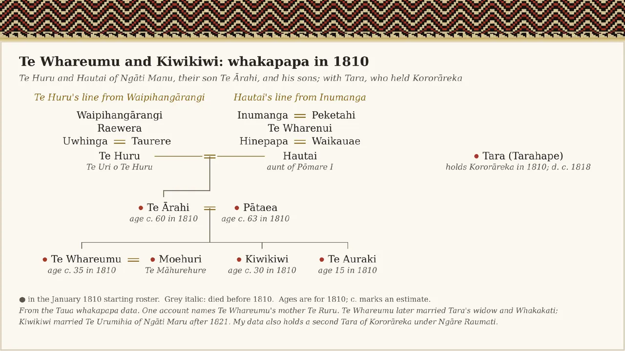
Image credits
- Augustus Earle, Kororadika Beach, Bay of Islands, published 1838. Public domain, via Wikimedia Commons.
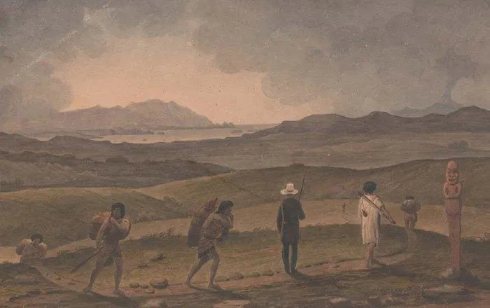
- Augustus Earle, Distant View of the Bay of Islands, about 1827. Rex Nan Kivell Collection, National Library of Australia. Public domain, via Wikimedia Commons.
- Map and whakapapa chart: Taua data and base map.
Sources
- Angela Ballara, Taua: "Musket Wars", "Land Wars" or Tikanga?, 2003.
- Angela Ballara, "Pōmare II", Dictionary of New Zealand Biography, 1990.
- Angela Middleton, Pēwhairangi: Bay of Islands Missions and Māori 1814 to 1845, 2014.
- "Kiwikiwi", He Whakaputanga signatories, NZHistory, Manatū Taonga.
- "Te Whareumu", Wikipedia.
- Augustus Earle, A Narrative of a Nine Months' Residence in New Zealand in 1827, 1832.
- Jeffrey Sissons, Wiremu Wi Hongi and Pat Hohepa, Ngā Pūriri o Taiamai, 1987.
- Anne Salmond, Between Worlds: Early Exchanges between Maori and Europeans, 1773 to 1815, 1997.
Comments