Pā, kāinga and the human map: the art
This post covers how settlements and improvements will look on the map, and the idea running through it is that no settlement on the Taua map stays the same. A kāinga grows, raises a pā, spreads its gardens, empties and grows over, and the map shows each step. As with the Whenua art, the target is a Total War campaign map, seen from high above.
A place that changes
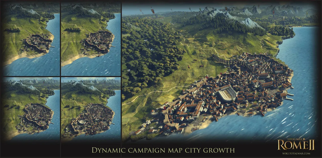
Total War: Rome II set the standard I'm aiming at. Its cities grow on the campaign map as you build. Creative Assembly previewed it below with Massalia, which starts as a walled town on the coast and ends as a city that has spilled past its walls along the shore and up the roads. Their note on a 2013 image of it says settlements grow in an organic way, can expand in several directions, and reflect your key building choices.
Taua takes four things from that. Size sets how much of a settlement there is: more houses, storehouses and gardens as its band rises. What a hapū builds shows where it stands: a palisade on the headland, pātaka by the houses, a canoe shed on the beach, a mission house next door. Gardens spread parcel by parcel across the land around the kāinga. And the landform sets the direction. Growth runs along the flats, the stream banks, the shore and the tracks, and climbs the hills last.
Kāinga and pā come as a pair. People live most of the year in the kāinga on the flats, near the gardens and the landing. The pā on the headland behind is where they go when danger comes. Either can grow while the other stands still.
Pieces and kits
A settlement that changes this much can't be one model. Like the nature art, it's built from a kit, and the game swaps and adds pieces as the place changes. The asset sheet holds 46 models in seven groups:
· defences: outer and main palisades, tall posts, gateways, fighting stages
· earthworks: ditches, banks, terraces, and the late works
· buildings: sleeping houses, cookhouses, temporary shelters, and houses with chimneys
· storage: pātaka, whata, kūmara pits and drying racks
· gardens: kūmara mounds, fences and windbreaks, stone rows, potato and wheat fields, fallow ground
· water and waka: waka taua, river and fishing canoes, canoe sheds, eel weirs
· Pākehā buildings and ships, plus dogs and pigs
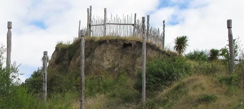
Twelve kits draw on those models, and the landform picks the kit. A headland pā cuts a ditch and bank across the neck and runs its palisade round the cliff edge. A ridge pā cuts ditches across the spur and terraces down the flanks. A volcanic cone pā rings the cone with terraces and storage pits, with stone rows on the gardens below. Island, swamp and lake pā each get their own kit, as do the open kāinga, the kāinga among its gardens, the seasonal fishing camp, and the later mission station, trade beach and whaling station.
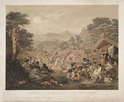
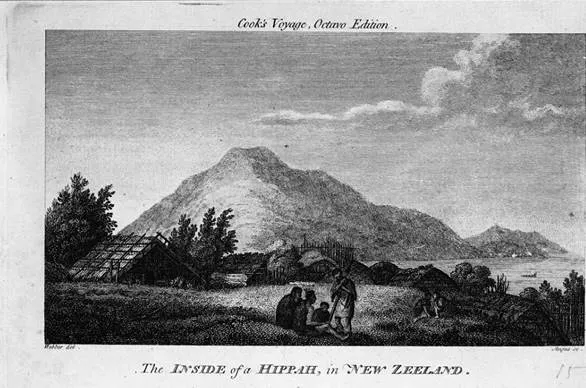
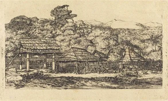
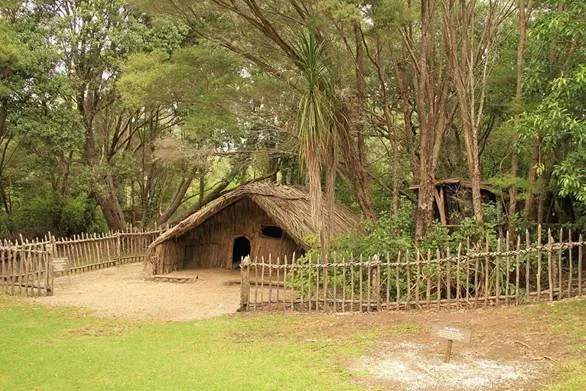
The historic drawings set the forms and materials. Raupō walls and roofs, nīkau in the north and toetoe and tussock in the south. Sunk floors and low doorways. Pātaka on one post or on four. Every timber model carries condition variants, new, weathered, rotting, broken and burnt, so the same pieces can show a place being built, lived in or left.
Building up: fortification tiers
Built defence in the data runs from 0 to 3, and the art follows it. Each tier switches a new set of pieces on.
· F0, open: houses and gardens, nothing built for defence.
· F1, fenced: a light palisade and one gateway.
· F2, palisade and ditch: a ditch and bank across the easy approach, an outer screen (pekerangi) and a main palisade, and fighting stages (pūwhara, or a small tower, taumaihi).
· F3, several enclosures: terraces, inner lines and a summit enclosure.
· F4, late works: low angled banks, pits outside the line, covered trenches, and a palisade screened with harakeke and raised off the ground. The game unlocks these late.
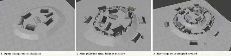
I've started blocking these out in Blender. The first pass shows the idea working: the outline changes at each step, even in grey. It also shows what the next pass has to fix. The rings are too round, where a real pā follows its ground. The house roofs curve where a whare puni keeps a straight ridge. The storehouses need to become pātaka on posts and rua at ground level, and every ring needs a gateway and, from F2, a ditch outside it.
At campaign height you won't count posts, so each tier has to change the outline: a thin ring at F1, a dark ditch line and raised stages at F2, stepped rings up the landform at F3. The late works read lower, broader and earth-coloured. In the 1810 data most places sit at F0 or F2, and only a handful reach F3.
Work in progress gets its own look. Fresh-cut posts show pale against weathered ones, new banks show raw earth, and a gap stays in the line until the work is done.
Growing out: size, gardens and direction
Size bands run from tiny to huge, and each band sets how many pieces a kit places. A tiny settlement shows a house or two with no name on the map. A huge one shows a couple of dozen houses, several storehouses and wide gardens. These counts are for reading the map at campaign height. They don't count houses, and the population figures stay in the data.
Gardens carry most of the growth. The land is already cut into parcels, each with a garden share, and as a hapū puts more people on the gardens, cultivation moves out from the kāinga one parcel at a time. It takes the warm flats and stream banks first, then the ground along the tracks, then the lower slopes. Potato fields open as rough clearings beside the kūmara plots. When a hapū pulls back, the outer parcels go fallow, then to bracken. A player can read a hapū's strength from how far its gardens reach.
Through the year: the gardens
The game runs in months, and the gardens change texture with them. Through winter people break and prepare the kūmara ground. The mounds go in from September to November, bare earth in neat rows. Over summer the vines cover them. The harvest comes in March and April, and the lifted ground sits broken in May. Potato fields keep their own calendar. New fields begin as felled bush, then burnt ground with stumps standing, and worked fields show fresh hills in spring and dug ground after the February harvest. The whata fill after harvest and stand bare through the hungry months.
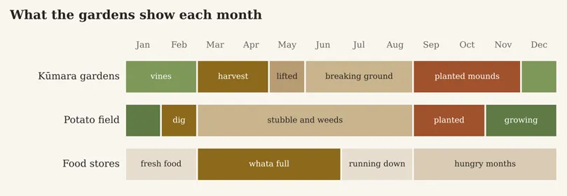
So a player who looks at a coastal hapū in October sees a different map from one who looks in March. The texture sets carry that change, and the garden models stay the same.
Running down: old works and decay
The gameplay post gave every place three states: empty ground, lived in, or old works. The art splits old works into stages so the map shows how long a place has stood empty.
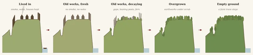
A lived-in place shows smoke from the cookhouses, waka on the beach, dogs and pigs, and gardens dressed for the month. When the people leave, the smoke and the waka go, and the doorways go dark. The gardens drop to fallow. Over the next few years the timber moves through its condition variants. Palisade posts lean and gaps open. Houses sag and fall in, and young bracken takes the gardens. Later only the earthworks remain: ditches, banks, terraces and the hollows of old kūmara pits, grassed or under scrub. At that point the ground passes to the nature land states, bracken and then mānuka and kānuka.
Earthworks never leave the map. Once a hapū cuts a ditch or a terrace, the terrain keeps a faint shape of it under the vegetation for the rest of the campaign. That's how old pā sites read in the land today, and it's why a place with old works costs less to settle again. When people return, the kit picks up the pieces still standing.
Over sixty years: contact
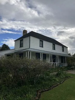
Contact changes the map year by year, and the asset sheet tracks when each new piece can first appear. In 1810 the north already has pigs, potatoes and iron tools, and ships are rare. Mission houses, chapels, post and rail fences and wheat follow the missions from 1814. Trade posts and a shipyard follow the traders in the 1820s. Houses with chimneys, whaling stations, stone stores and, later, water mills and hapū-owned schooners come after. None of it appears on a date alone. A rangatira invites a missionary or a trader and builds them up, as the gameplay post set out, and the buildings arrive with them, beside the pā that asked for them.
Whakairo
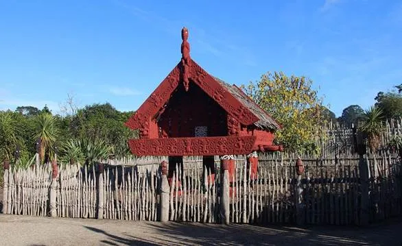
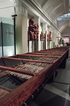
Carving is the hardest part of this art, and I'm taking my time with it. Every carved surface in the game ships plain: palisade posts, gateways, pātaka, waka prows and sternposts, chiefs' houses. Each has a generic form, a post head or a gable or a prow as a shape, with no designs cut into it. The carving designs will come from working with iwi. I won't copy them from museum pieces or from the historic drawings, because they belong to their people and carry their whakapapa. The asset sheet keeps a consult list, and nothing on it moves past its placeholder until the people it belongs to have had their say.
Wāhi tapu
The rule from the first two posts holds. Burial places stay off the map, and the game shows no remains of any kind. Tūāhu and other sacred places wait for consultation before I model them.
That closes this set on the human map. If you hold kōrero about how a pā, a kāinga or a garden looked, or how it grew, that differs from what I have here, I want to hear it. Combat comes next.
Image credits
· Angus after John Webber, The Inside of a Hippah, in New Zeeland, Cook's Voyage, octavo edition. Library of Congress. Public domain, via Wikimedia Commons.
· John Alexander Gilfillan, Interior of a native village or "pa" in New Zealand, Day & Son, 1850. Alexander Turnbull Library. Public domain, via Wikimedia Commons.
· Charles Meryon, Greniers indigènes et habitations à Akaroa, 1865. National Gallery of Art. CC0, via Wikimedia Commons.
· Barb Nicolle, Otatara Pa, Hawke's Bay, 2010. CC BY-SA 2.0, via Wikimedia Commons.
· Michal Klajban, Te Parapara Maori Garden, Hamilton Gardens, 2016. CC BY-SA 4.0, via Wikimedia Commons.
· Ronnie Macdonald, Rewa's Village, 2011. CC BY 2.0, via Wikimedia Commons.
· LadyRabbit, Kemp House, Kerikeri, 2025. CC BY-SA 4.0, via Wikimedia Commons.
· Szilas, Auckland War Memorial Museum, part of a Māori canoe, 2016. Public domain, via Wikimedia Commons.
· Diagrams: Taua.
Sources
· Elsdon Best, The Pa Maori, Dominion Museum Bulletin 6, 1927.
· Elsdon Best, "Maori Agriculture", Journal of the Polynesian Society 39 and 40, 1930 and 1931.
· Edward Shortland, Traditions and Superstitions of the New Zealanders, 1854, as cited in M. Simmons, 1975.
· Te Aka Māori Dictionary, for pekerangi, pūwhara and taumaihi.
· Total War, "To showcase the incredible detail in ROME II's campaign map", Facebook, 13 August 2013.
Comments