A map of Aotearoa in 1810
I’ve made an online viewer of the whenua and settlement editor so you can view how filled in the land is as of current. I’ll try update it as I insert more data in from various wai reports.
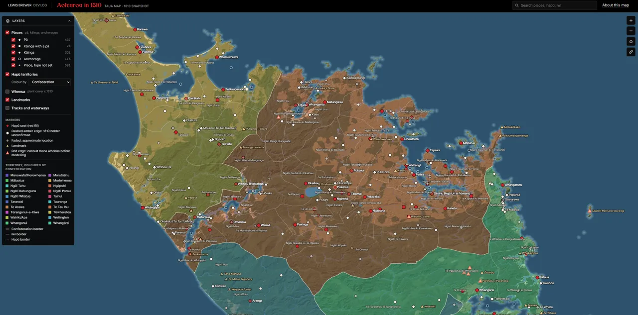
What you can see
- Whenua: forest, swamp, fern and open ground, with the rivers and lakes.
- Settlements: pā, kāinga and anchorages.
- Hapū territories: the land each hapū held in 1810, grown out from the places it controlled.
- Landmarks: maunga and other named places that stand out from the terrain.
- Tracks: walking tracks, river routes, sea lanes and portages.
Click a place to see its type, its hapū and iwi, the rangatira who held it, a population estimate from the game’s model, and the sources behind it. Search finds a place by name.
The map is a working draft. Places I haven’t confirmed carry a mark, and so do positions I’ve estimated. Places that wait on consultation have a red edge. I’d rather show the gaps than hide them. If you know a place better than the map does, let me know.
Comments